
Other ITA web sites:
Dana Volcano, USA
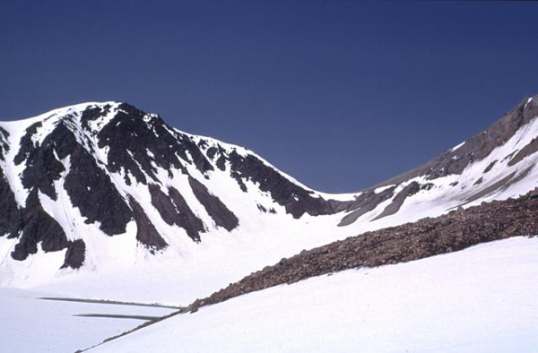
Snow-covered Knutson Lake (lower left) lies within a 1.5 x 2 km wide crater of Mount Dana.
The 1354-m-high Dana is a small calc-alkaline volcano consisting of a central dome complex surrounded by an apron of volcaniclastic debris.
Andesitic lava domes occur on the west crater rim and as a small mound east of Knutson Lake inside the crater.
A major eruption from Mount Dana about 3840 radiocarbon years ago produced a block-and-ash flow that filled valleys south and west of the crater.
Mount Dana is a small calc-alkaline volcano NE of Canoe Bay inlet at the head of Pavlof Bay consisting of an apron of volcaniclastic debris surrounding a central dome complex.
The 1354-m high point is located at the north rim of a 1.5 x 2 km crater, whose SW rim exposes Mesozoic sedimentary rocks.
Andesitic lava domes occur on the west crater rim and as a small mound east of Knutson Lake inside the crater.
Mount Dana is the source of a mid-Holocene block-and-ash flow that reached the sea at Canoe Bay.
No historical eruptions are known from Dana, but a 200-m-wide tufa mound and several cold springs are located on the SW flank of the volcano.
PHOTO SOURCE: courtesy of U.S. Geological Survey, Alaska Volcano Observatory, 1973, courtesy of the Global Volcanism Program, Smithsonian National Museum of Natural History, used with permission.
NOTE: The information regarding Volcano on this page is re-published from other sources. No claims are made regarding the accuracy of Volcano information contained here. All suggestions for corrections of any errors about Volcano photos should be addressed to the copyright owner noted below the photo.